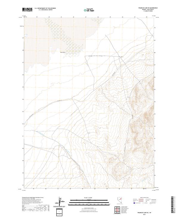
2021 Map of Franklin Lake SE
USGS Topo · Published 2021About this map
Ruby Valley dominates this section of eastern Elko County, showcasing a landscape defined by seasonal water drainage and historical ranching corridors. The area is characterized by the expansive alluvial fan where Ruby Wash descends from the highlands, carving a path toward the valley floor. The placement of Ruby Wash Rd suggests the continued importance of this route for accessing the remote high-desert basins of Nevada. To the southeast, the terrain shifts near Cabin Run, reflecting the complex hydrography of this high-elevation valley system. This 2021 edition provides a clear picture of the modern land management boundaries, including several townships and ranges such as t29n r59e and t28n r60e, which are critical for tracing property history and public land survey records in this part of the Great Basin.
Find a feature on this map
10 named features on this map. Tap any name to fly to it.
Don’t see what you’re looking for? This feature index may not catch every label — zoom into the map to look around manually.
Map Details
Editions of this 2021 Franklin Lake SE Map
This is the sole edition of this map. No revisions or reprints were ever made.
Other maps of this area

1955 · Elko
USGS Topo · 1:250,000

1958 · Elko
USGS Topo · 1:250,000

1962 · Elko
USGS Topo · 1:250,000

1965 · Elko
USGS Topo · 1:250,000

1968 · Franklin Lake SE
USGS Topo · 1:24,000

1968 · Franklin Lake SW
USGS Topo · 1:24,000

1968 · Franklin Lake NE
USGS Topo · 1:24,000
1968 · Ruby Lake NW
USGS Topo · 1:24,000

1968 · Ruby Lake NE
USGS Topo · 1:24,000
1969 · Franklin Lake NW
USGS Topo · 1:24,000