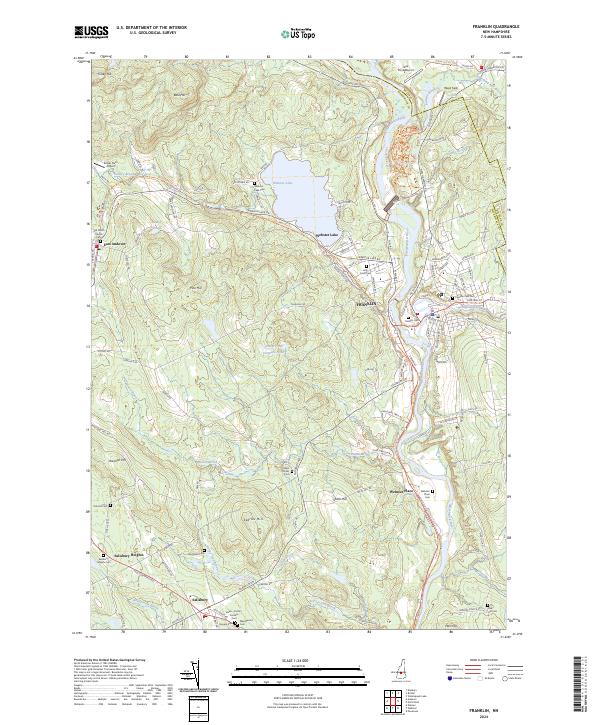
2024 Map of Franklin
USGS Topo · Published 2024About this map
The Pemigewasset River and Winnipesaukee River converge to form the Merrimack River at the industrial heart of Franklin. This map details the town's position at the headwaters, where water power and transportation routes defined the settlement's growth. The Northern Rail Trl follows the old rail corridor west through East Andover, skirting the southern shore of Webster Lake. This recreational corridor replaces the former heavy rail line that once linked the Merrimack valley with northern New Hampshire markets.
Find a feature on this map
127 named features on this map. Tap any name to fly to it.
Don’t see what you’re looking for? This feature index may not catch every label — zoom into the map to look around manually.
Map Details
Editions of this 2024 Franklin Map
This is the sole edition of this map. No revisions or reprints were ever made.
Other maps of this area

1925 · Holderness
USGS Topo · 1:62,500

1927 · Penacook
USGS Topo · 1:62,500

1927 · Holderness
USGS Topo · 1:62,500

1927 · Cardigan
USGS Topo · 1:62,500

1928 · Mount Kearsarge
USGS Topo · 1:62,500

1930 · Cardigan
USGS Topo · 1:62,500

1931 · Mount Kearsarge
USGS Topo · 1:62,500

1949 · Portland
USGS Topo · 1:250,000

1956 · Cardigan
USGS Topo · 1:62,500

1956 · Penacook
USGS Topo · 1:62,500