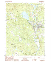
1987 Map of Franklin
USGS Topo · Published 1987About this map
Daniel Webster Birthplace stands as a central historical landmark in this New Hampshire landscape, situated south of the sprawling Webster Lake. The map captures the convergence of the Pemigewasset and Winnipesaukee rivers to form the Merrimack River, a geographic focal point that shaped the development of Franklin. This area shows a transition from the industrial and residential concentration in the river valley to the upland farms and woodlots of Salisbury and Andover.
Find a feature on this map
48 named features on this map. Tap any name to fly to it.
Don’t see what you’re looking for? This feature index may not catch every label — zoom into the map to look around manually.
Map Details
Editions of this 1987 Franklin Map
This is the sole edition of this map. No revisions or reprints were ever made.
Other maps of this area

1925 · Holderness
USGS Topo · 1:62,500

1927 · Penacook
USGS Topo · 1:62,500

1927 · Holderness
USGS Topo · 1:62,500

1927 · Cardigan
USGS Topo · 1:62,500

1928 · Mount Kearsarge
USGS Topo · 1:62,500

1930 · Cardigan
USGS Topo · 1:62,500

1931 · Mount Kearsarge
USGS Topo · 1:62,500

1949 · Portland
USGS Topo · 1:250,000

1956 · Cardigan
USGS Topo · 1:62,500

1956 · Penacook
USGS Topo · 1:62,500