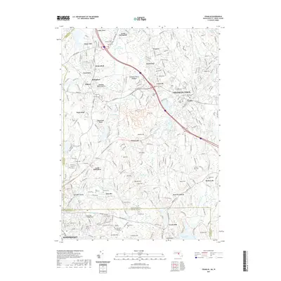
2021 Map of Franklin
USGS Topo · Published 2021About this map
The Charles River winds through this borderland of Massachusetts and Rhode Island, connecting a network of mill-era settlements and residential growth. In Franklin Town, the campus of Dean College sits near the historic center, while smaller communities like Rakeville, Wadsworth, and Sheldonville dot the landscape. The region's burial grounds, including the Elder Ballou Meeting House Cem and North Bellingham Cem, provide deep genealogical anchors for local families.
Find a feature on this map
97 named features on this map. Tap any name to fly to it.
Don’t see what you’re looking for? This feature index may not catch every label — zoom into the map to look around manually.
Map Details
Editions of this 2021 Franklin Map
This is the sole edition of this map. No revisions or reprints were ever made.
Other maps of this area

1886 · Blackstone
USGS Topo · 1:62,500

1887 · Franklin
USGS Topo · 1:62,500

1887 · Providence
USGS Topo · 1:62,500

1889 · Providence
USGS Topo · 1:62,500

1889 · Blackstone
USGS Topo · 1:62,500

1889 · Franklin
USGS Topo · 1:62,500

1889 · Burrillville
USGS Topo · 1:62,500

1893 · Franklin
USGS Topo · 1:62,500

1893 · Blackstone
USGS Topo · 1:62,500

1894 · Burrillville
USGS Topo · 1:62,500