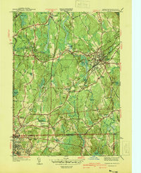
1940 Map of Franklin
USGS Topo · Published 1940About this map
The town of Franklin serves as a primary hub of this 1930s landscape, centered around the Dean Academy and the busy intersection of the New York New Haven and Hartford RR. The terrain is defined by a series of prominent rises including Forge Hill, Bright Hill, and Pigeon Hill, with the Charles River winding through the western portion near North Bellingham. Social and industrial life is marked by local landmarks like St Marys Ch and the specialized Sewage Disposal plant near Unionville.
Find a feature on this map
79 named features on this map. Tap any name to fly to it.
Don’t see what you’re looking for? This feature index may not catch every label — zoom into the map to look around manually.
Map Details
Editions of this 1940 Franklin Map
2 editions found
Other maps of this area

1886 · Blackstone
USGS Topo · 1:62,500

1887 · Franklin
USGS Topo · 1:62,500

1887 · Providence
USGS Topo · 1:62,500

1889 · Providence
USGS Topo · 1:62,500

1889 · Blackstone
USGS Topo · 1:62,500

1889 · Franklin
USGS Topo · 1:62,500

1889 · Burrillville
USGS Topo · 1:62,500

1893 · Franklin
USGS Topo · 1:62,500

1893 · Blackstone
USGS Topo · 1:62,500

1894 · Burrillville
USGS Topo · 1:62,500