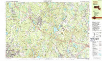
1987 Map of Franklin
USGS Topo · Published 1987About this map
The town of Franklin and the surrounding borderlands of Massachusetts and Rhode Island are defined by a mix of dense woodland and growing suburban infrastructure during the late 1980s. The Conrail line cuts through the landscape, linking settlements such as Unionville and City Mills to the larger rail network. Large institutional footprints are prominent, including the Wrentham State School, the Pondville Hospital, and correctional facilities in Norfolk and South Walpole.
Find a feature on this map
152 named features on this map. Tap any name to fly to it.
Don’t see what you’re looking for? This feature index may not catch every label — zoom into the map to look around manually.
Map Details
Editions of this 1987 Franklin Map
2 editions found
Other maps of this area

1885 · Taunton
USGS Topo · 1:62,500

1886 · Blackstone
USGS Topo · 1:62,500

1886 · Dedham
USGS Topo · 1:62,500

1887 · Franklin
USGS Topo · 1:62,500

1887 · Providence
USGS Topo · 1:62,500

1888 · Taunton
USGS Topo · 1:62,500

1889 · Providence
USGS Topo · 1:62,500

1889 · Blackstone
USGS Topo · 1:62,500

1889 · Franklin
USGS Topo · 1:62,500

1889 · Burrillville
USGS Topo · 1:62,500