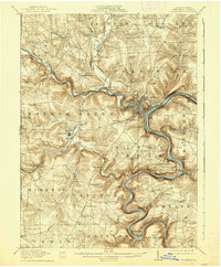
1911 Map of Franklin
USGS Topo · Published 1938About this map
The Allegheny River and French Creek converge at The Point in Franklin, forming a deep industrial and transport hub at the turn of the century. This landscape is defined by the heavy infrastructure of the era, where the L. S. and M. S. R. R. and Pennsylvania R. R. hug the winding riverbanks. The settlement patterns follow the narrow valleys and plateaus, with communities like Rocky Grove and Uniontown establishing themselves near the urban core, while the surrounding townships maintain a dense network of rural landmarks.
Find a feature on this map
95 named features on this map. Tap any name to fly to it.
Don’t see what you’re looking for? This feature index may not catch every label — zoom into the map to look around manually.
Map Details
Editions of this 1911 Franklin Map
4 editions found
Other maps of this area

1907 · Foxburg
USGS Topo · 1:62,500

1908 · Foxburg
USGS Topo · 1:62,500

1909 · Franklin
USGS Topo · 1:62,500

1910 · Hilliards
USGS Topo · 1:62,500

1911 · Franklin
USGS Topo · 1:62,500

1911 · Stoneboro
USGS Topo · 1:62,500

1912 · Hilliards
USGS Topo · 1:62,500

1913 · Stoneboro
USGS Topo · 1:62,500

1913 · Mercer
USGS Topo · 1:62,500

1922 · Oil City
USGS Topo · 1:48,000