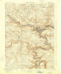
1911 Map of Franklin
USGS Topo · Published 1924About this map
Franklin serves as the industrial and administrative hub of Venango County in this 1909 survey, positioned at the critical junction where French Creek meets the winding Allegheny River. The era's heavy reliance on rail is evident in the dense network of lines, including the Erie RR and Pennsylvania RR, which follow the riverbanks to serve riverside communities like Reno and Eclipse. Beyond the city center, the landscape transitions into a series of named hills and runs, dotted with rural institutions such as the Oak Forest School and the Bethel Church.
Find a feature on this map
102 named features on this map. Tap any name to fly to it.
Don’t see what you’re looking for? This feature index may not catch every label — zoom into the map to look around manually.
Map Details
Editions of this 1911 Franklin Map
4 editions found
Other maps of this area

1907 · Foxburg
USGS Topo · 1:62,500

1908 · Foxburg
USGS Topo · 1:62,500

1909 · Franklin
USGS Topo · 1:62,500

1910 · Hilliards
USGS Topo · 1:62,500

1911 · Franklin
USGS Topo · 1:62,500

1911 · Stoneboro
USGS Topo · 1:62,500

1912 · Hilliards
USGS Topo · 1:62,500

1913 · Stoneboro
USGS Topo · 1:62,500

1913 · Mercer
USGS Topo · 1:62,500

1922 · Oil City
USGS Topo · 1:48,000