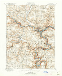
1909 Map of Franklin
USGS Topo · Published 1962About this map
Franklin serves as the industrial and transport hub of Venango County at the dawn of the twentieth century, situated at the confluence of French Creek and the Allegheny River. The landscape reveals a transition from nineteenth-century infrastructure to modern rail systems, shown by the remnants of the Waterford and Erie Canal and the long-established Susquehanna and Waterford Turnpike. The surrounding townships of Victory, Sugarcreek, and Sandy Creek are dotted with neighborhood institutions like Hebron Church and Five Points School, alongside industrial settlements such as Coal City. West of the river, the State Institute for Feeble Minded stands near Polk, while the winding Allegheny serves smaller stops like Kennerdell and Brandon. This survey documents a critical period of regional development, illustrating how geography and early transportation corridors shaped the placement of local schools, churches, and mining hamlets.
Find a feature on this map
97 named features on this map. Tap any name to fly to it.
Don’t see what you’re looking for? This feature index may not catch every label — zoom into the map to look around manually.
Map Details
Editions of this 1909 Franklin Map
2 editions found
Other maps of this area

1907 · Foxburg
USGS Topo · 1:62,500

1908 · Foxburg
USGS Topo · 1:62,500

1909 · Franklin
USGS Topo · 1:62,500

1910 · Hilliards
USGS Topo · 1:62,500

1911 · Franklin
USGS Topo · 1:62,500

1911 · Stoneboro
USGS Topo · 1:62,500

1912 · Hilliards
USGS Topo · 1:62,500

1913 · Stoneboro
USGS Topo · 1:62,500

1913 · Mercer
USGS Topo · 1:62,500

1922 · Oil City
USGS Topo · 1:48,000