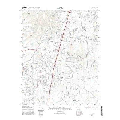
2016 Map of Franklin
USGS Topo · Published 2016About this map
Franklin and Brentwood anchor this detailed landscape in Williamson County, revealing a modern suburban geography still deeply marked by its nineteenth-century roots. The area around Figuers Bluff and the Harpeth River is home to significant historical sites, most notably the Confederate Cem and McGavock Cem, situated near the sprawling Williamson Memorial Gardens. The landscape is a mix of high-density residential development and preserved heritage, including the ancient Boiling Springs Mounds near Seward Hills.
Find a feature on this map
93 named features on this map. Tap any name to fly to it.
Don’t see what you’re looking for? This feature index may not catch every label — zoom into the map to look around manually.
Map Details
Editions of this 2016 Franklin Map
This is the sole edition of this map. No revisions or reprints were ever made.
Other maps of this area

1903 · Nashville
USGS Topo · 1:125,000

1909 · Franklin
USGS Topo · 1:62,500

1932 · Hermitage
USGS Topo · 1:62,500

1932 · Nashville
USGS Topo · 1:62,500

1936 · Spring Hill
USGS Topo · 1:24,000

1936 · Bethesda
USGS Topo · 1:24,000

1942 · Lebanon
USGS Topo · 1:100,000

1946 · Leipers Fork
USGS Topo · 1:24,000

1946 · Bethesda
USGS Topo · 1:24,000
1946 · Spring Hill
USGS Topo · 1:24,000