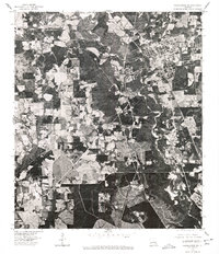
1976 Map of Franklinton SW
USGS Topo · Published 1977About this map
Franklinton anchors the northeastern corner of this 1976 orthophotoquad, serving as a clear visual record of the parish seat's expansion and street layout during the mid-1970s. The photographic nature of the map, produced by the U.S. Geological Survey, reveals the intricate meandering path of the Bogue Chitto river as it snakes south through Washington Parish. Unlike traditional line-drawn maps, this aerial perspective provides an unfiltered view of the agricultural patterns, timber tracts, and road networks that defined the rural landscape. Geologists and local historians can observe the sharp contrast between the developed town center and the dense woodland and river bottoms that characterize this portion of southeast Louisiana, documenting the exact footprint of human settlement and natural drainage before modern developments altered the terrain.
Find a feature on this map
2 named features on this map. Tap any name to fly to it.
Don’t see what you’re looking for? This feature index may not catch every label — zoom into the map to look around manually.
Map Details
Editions of this 1976 Franklinton SW Map
This is the sole edition of this map. No revisions or reprints were ever made.
Other maps of this area

1939 · Zona
USGS Topo · 1:31,680

1939 · Sunny Hill
USGS Topo · 1:31,680

1939 · Clifton
USGS Topo · 1:31,680

1942 · Husser
USGS Topo · 1:31,680

1942 · Thigpen
USGS Topo · 1:31,680

1942 · Wilmer
USGS Topo · 1:31,680

1942 · Thomas
USGS Topo · 1:31,680

1950 · Folsom
USGS Topo · 1:31,680

1950 · Franklinton
USGS Topo · 1:31,680

1954 · Folsom
USGS Topo · 1:62,500