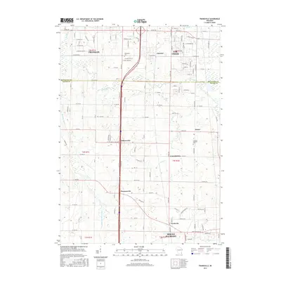
2016 Map of Franksville
USGS Topo · Published 2016About this map
Franklin and Oak Creek anchor the northern reaches of this Wisconsin landscape, where the southern suburban edge of Milwaukee meets the agricultural heritage of Racine County. The map documents a complex transition between residential development and the rural grid, centered on the corridor of Interstate 94. A series of small historic crossroads and settlements, including Kilbournville, Thompsonville, and Husher, are situated among the headwaters and tributaries of the Root River. In the southern half, Franksville sits near the border of Caledonia and Mount Pleasant, reflecting the area's long history of organized township settlement. Cultural markers like the Independent Cem and Caledonia Memorial Park provide genealogical touchpoints, while the engineered paths of the Root River Canal and E Br Root River Canal illustrate the region's managed drainage and hydrology.
Find a feature on this map
101 named features on this map. Tap any name to fly to it.
Don’t see what you’re looking for? This feature index may not catch every label — zoom into the map to look around manually.
Map Details
Editions of this 2016 Franksville Map
This is the sole edition of this map. No revisions or reprints were ever made.
Other maps of this area

1891 · Bayview
USGS Topo · 1:62,500

1891 · Muskego
USGS Topo · 1:62,500

1892 · Racine
USGS Topo · 1:62,500

1893 · Silver Lake
USGS Topo · 1:62,500

1901 · Bayview
USGS Topo · 1:62,500

1901 · Muskego
USGS Topo · 1:62,500

1905 · Racine
USGS Topo · 1:62,500

1906 · Silver Lake
USGS Topo · 1:62,500

1954 · Rockford
USGS Topo · 1:250,000

1955 · Rockford
USGS Topo · 1:250,000