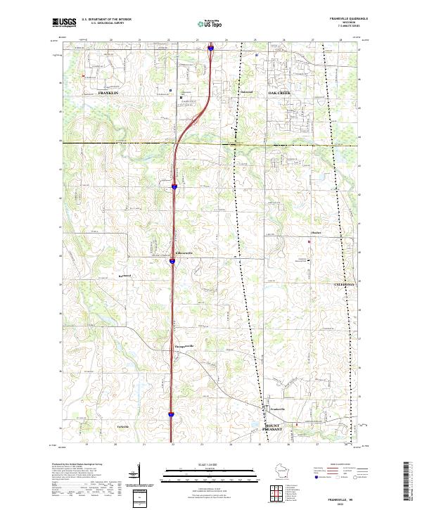
2022 Map of Franksville
USGS Topo · Published 2022About this map
The Milwaukee Co Racine Co line bisects this region where the suburban expansion of Franklin and Oak Creek meets the agricultural townships of Caledonia and Mount Pleasant. This 2022 survey captures a landscape defined by its drainage and its grid, where the Root River and its associated Root River Canal system wind through terrain that remains largely pastoral despite the presence of major transit corridors. Historically significant clusters like Franksville and Thompsonville serve as anchors in a region where local landmarks such as Independent Cem and Caledonia Memorial Park provide clear points of reference for genealogists. The map details the transition from the developed streets of Oakwood in the north to the more open farm plots near Yorkville and Raymond, tracing the evolution of southeastern Wisconsin's land use.
Find a feature on this map
74 named features on this map. Tap any name to fly to it.
Don’t see what you’re looking for? This feature index may not catch every label — zoom into the map to look around manually.
Map Details
Editions of this 2022 Franksville Map
This is the sole edition of this map. No revisions or reprints were ever made.
Other maps of this area

1891 · Bayview
USGS Topo · 1:62,500

1891 · Muskego
USGS Topo · 1:62,500

1892 · Racine
USGS Topo · 1:62,500

1893 · Silver Lake
USGS Topo · 1:62,500

1901 · Bayview
USGS Topo · 1:62,500

1901 · Muskego
USGS Topo · 1:62,500

1905 · Racine
USGS Topo · 1:62,500

1906 · Silver Lake
USGS Topo · 1:62,500

1954 · Rockford
USGS Topo · 1:250,000

1955 · Rockford
USGS Topo · 1:250,000