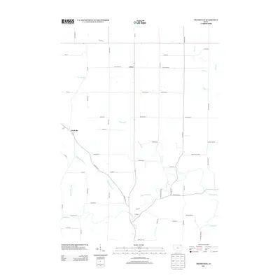
2013 Map of Frankville
USGS Topo · Published 2013About this map
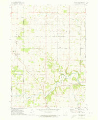
The Yellow River and its intricate drainage network define the rural landscape of Winneshiek County in this 2013 survey. Small clusters of settlement at Frankville, Ludlow, and Cleveland anchor a territory crisscrossed by historic routes such as Old Stage Rd and Frankville Rd. The topography is dominated by the erosive action of numerous waterways, including the Upper Br Yellow Cr, Cook Slough, and the N Fork Yellow River, which carve through the Iowa countryside. These streams and their tributaries, like Teeple Cr and Hecker Cr, suggest a region shaped by agricultural drainage and natural springs, evidenced by local markers like Livingood Springs Rd. The map layout reflects a transition from rigid section-line roads to paths that follow the winding descent of the river valleys toward the southeast.
Find a feature on this map
54 named features on this map. Tap any name to fly to it.
Don’t see what you’re looking for? This feature index may not catch every label — zoom into the map to look around manually.
Map Details
Editions of this 2013 Frankville Map
This is the sole edition of this map. No revisions or reprints were ever made.
Other maps of this area

1903 · Waukon
USGS Topo · 1:125,000

1906 · Decorah
USGS Topo · 1:125,000

1958 · La Crosse
USGS Topo · 1:250,000

1961 · La Crosse
USGS Topo · 1:250,000

1965 · La Crosse
USGS Topo · 1:250,000

1968 · Waukon
USGS Topo · 1:24,000
1971 · Postville
USGS Topo · 1:24,000
1971 · Rossville
USGS Topo · 1:24,000
1971 · Monona
USGS Topo · 1:24,000
1971 · Frankville
USGS Topo · 1:24,000