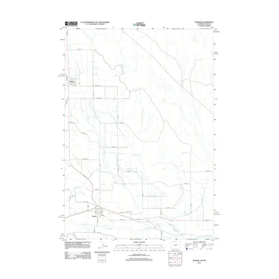
2012 Map of Frannie
USGS Topo · Published 2012About this map
Deaver and Frannie serve as the primary anchors in this northern Wyoming landscape, where human settlement is defined by an intricate network of irrigation and transportation. The Frannie Canal and Deaver Canal weave through the terrain, supporting the agricultural lifeblood of the region near the Montana border. This 2012 survey illustrates a grid of rural roads like Colane 1 and Road 1 that connect disparate farmsteads and fields. Natural drainage through Sage Creek and Polecat Creek contrasts with the straight lines of the man-made waterways. For those tracing local history, the Deaver Cem sits just outside the town of Deaver, while the Jim Bridger Trl hints at the deeper historical pathways that preceded the modern road system.
Find a feature on this map
47 named features on this map. Tap any name to fly to it.
Don’t see what you’re looking for? This feature index may not catch every label — zoom into the map to look around manually.
Map Details
Editions of this 2012 Frannie Map
This is the sole edition of this map. No revisions or reprints were ever made.
Other maps of this area

1954 · Billings
USGS Topo · 1:250,000

1955 · Cody
USGS Topo · 1:250,000

1957 · Billings
USGS Topo · 1:250,000

1958 · Billings
USGS Topo · 1:250,000

1958 · Cody
USGS Topo · 1:250,000

1962 · Cody
USGS Topo · 1:250,000

1964 · Red Pryor Mountain
USGS Topo · 1:24,000

1966 · Frannie
USGS Topo · 1:24,000

1966 · Garland
USGS Topo · 1:24,000

1966 · Cowley
USGS Topo · 1:24,000