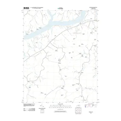
2010 Map of Frazer
USGS Topo · Published 2010About this map
The Cumberland River and its tributary, Fishing Creek, dominate the northern landscape of this Wayne County region. The terrain is defined by a dense network of hollows and ridges, including Stillhouse Hollow, Gaiths Hollow, and the prominent Doc Kidd Ridge. For genealogists, the map is particularly detailed in its identification of family-named burial grounds, such as Prather Cemetery, John Simpson Cemetery, and the Carrender-Tuttle Cemetery.
Find a feature on this map
92 named features on this map. Tap any name to fly to it.
Don’t see what you’re looking for? This feature index may not catch every label — zoom into the map to look around manually.
Map Details
Editions of this 2010 Frazer Map
This is the sole edition of this map. No revisions or reprints were ever made.
Other maps of this area

1911 · Monticello
USGS Topo · 1:62,500

1914 · Monticello
USGS Topo · 1:62,500

1932 · Burnside
USGS Topo · 1:62,500

1935 · Somerset
USGS Topo · 1:62,500

1953 · Frazer
USGS Topo · 1:24,000

1953 · Monticello
USGS Topo · 1:24,000

1953 · Mill Springs
USGS Topo · 1:24,000

1954 · Coopersville
USGS Topo · 1:24,000

1954 · Burnside
USGS Topo · 1:24,000

1954 · Delmer
USGS Topo · 1:24,000