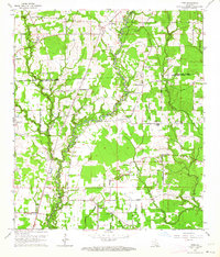
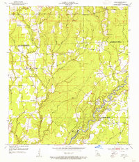
1963 Map of Fred
USGS Topo · Published 1964About this map
The Comite River and its many tributaries, including Redwood Creek and Beaver Bayou, carve through the rural landscape of northern East Baton Rouge Parish in this 1963 survey. Small farming communities and crossroad settlements like Slaughter, Fred, and Deerford anchor the region, connected by a network of local routes such as Zeb Chaney Road and Lemon Road. The map reveals a high density of rural religious life and family history, with numerous small country churches and cemeteries marking the terrain.
Find a feature on this map
58 named features on this map. Tap any name to fly to it.
Don’t see what you’re looking for? This feature index may not catch every label — zoom into the map to look around manually.
Map Details
Editions of this 1963 Fred Map
3 editions found
Other maps of this area

1906 · Bayou Sara
USGS Topo · 1:125,000

1939 · Zachary
USGS Topo · 1:62,500

1942 · Pride
USGS Topo · 1:31,680

1942 · Watson
USGS Topo · 1:31,680

1945 · Jackson
USGS Topo · 1:31,680

1946 · Clinton
USGS Topo · 1:31,680

1949 · Bluff Creek
USGS Topo · 1:31,680

1953 · Comite
USGS Topo · 1:24,000
1954 · Watson
USGS Topo · 1:24,000
1954 · Pride
USGS Topo · 1:24,000