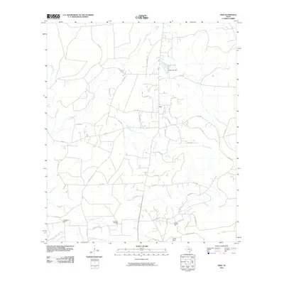
2010 Map of Fred
USGS Topo · Published 2010About this map
Fred serves as a central hub for this portion of Tyler County, defined by a network of county roads and a landscape interwoven with petroleum extraction. The local economy and geography are anchored by the Fortenberry West Oil Field, East Beech Creek Oil Field, and Jackson-Doty Oil Field, indicating the persistent industrial character of the region. Waterways like Beech Creek and Franks Branch create a dendritic drainage pattern across the terrain, leading toward George Lake and its associated dam. Roadways such as Drakeville Rd, McGallion Rd, and Caneyhead Rd provide a clear view of the rural residential and industrial infrastructure. The presence of settlements like Caney Head and named family roads like Eddings Rd offers valuable points of reference for genealogists and local historians tracing the development of this Texas landscape.
Find a feature on this map
48 named features on this map. Tap any name to fly to it.
Don’t see what you’re looking for? This feature index may not catch every label — zoom into the map to look around manually.
Map Details
Editions of this 2010 Fred Map
This is the sole edition of this map. No revisions or reprints were ever made.
Other maps of this area

1954 · Beaumont
USGS Topo · 1:250,000

1955 · Silsbee
USGS Topo · 1:62,500

1955 · Kountze
USGS Topo · 1:62,500

1957 · Beaumont
USGS Topo · 1:250,000

1958 · Warren
USGS Topo · 1:62,500

1958 · Spurger
USGS Topo · 1:62,500

1984 · Beaumont
USGS Topo · 1:250,000

1984 · Potato Patch Lake
USGS Topo · 1:24,000
1984 · Spurger
USGS Topo · 1:24,000
1984 · Deserter Baygall
USGS Topo · 1:24,000