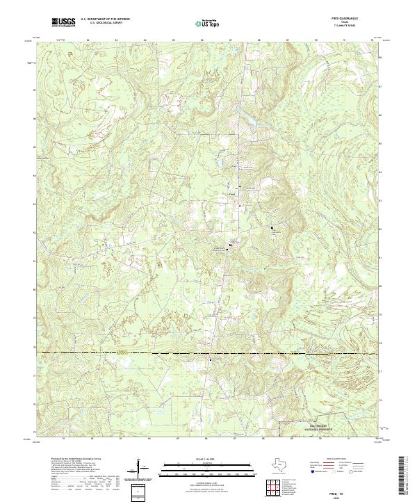
2022 Map of Fred
USGS Topo · Published 2022About this map
The unincorporated community of Fred serves as the central hub of this East Texas landscape, where the sandy pine barrens meet the dense riparian ecosystems of the Big Thicket National Preserve. The area's social history is recorded in its scattered burial grounds, including the Franks Branch Community Cem and the Fred Community Cem, which speak to the long-standing family lineages in this corner of Tyler County. The terrain is defined by a network of waterways like Beech Creek and Franks Branch, which feed into the more substantial Mill Creek near the southern boundary. To the north, George Lake provides a notable landmark amidst a grid of rural roads and timber tracks. This modern survey illustrates the persistent rural character of the region, where hunting culture, as evidenced by Triple L Hunting Club Rd, and conservation efforts coexist along the county line.
Find a feature on this map
77 named features on this map. Tap any name to fly to it.
Don’t see what you’re looking for? This feature index may not catch every label — zoom into the map to look around manually.
Map Details
Editions of this 2022 Fred Map
This is the sole edition of this map. No revisions or reprints were ever made.
Other maps of this area

1954 · Beaumont
USGS Topo · 1:250,000

1955 · Silsbee
USGS Topo · 1:62,500

1955 · Kountze
USGS Topo · 1:62,500

1957 · Beaumont
USGS Topo · 1:250,000

1958 · Warren
USGS Topo · 1:62,500

1958 · Spurger
USGS Topo · 1:62,500

1984 · Beaumont
USGS Topo · 1:250,000

1984 · Potato Patch Lake
USGS Topo · 1:24,000
1984 · Spurger
USGS Topo · 1:24,000
1984 · Deserter Baygall
USGS Topo · 1:24,000