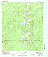
1984 Map of Fred
USGS Topo · Published 1985About this map
The settlement of Fred serves as the focal point for this 1984 survey of the East Texas piney woods, situated near the Tyler Co Hardin Co line. This landscape is defined by its intricate drainage network, where Beech Creek and Spring Branch cut through the terrain, eventually feeding toward the Big Thicket National Preserve in the south. The map documents the rural character of the era, noting small clusters of activity at Franks and several local Cem sites that provide essential clues for genealogical research. An Indefinite Boundary near Mill Creek suggests the complex nature of local land divisions and riparian borders during this period. To the southeast, the terrain shifts as it approaches Maple Slough, illustrating the transition into the dense, protected bottomlands of the regional preserve.
Find a feature on this map
13 named features on this map. Tap any name to fly to it.
Don’t see what you’re looking for? This feature index may not catch every label — zoom into the map to look around manually.
Map Details
Editions of this 1984 Fred Map
This is the sole edition of this map. No revisions or reprints were ever made.
Other maps of this area

1954 · Beaumont
USGS Topo · 1:250,000

1955 · Silsbee
USGS Topo · 1:62,500

1955 · Kountze
USGS Topo · 1:62,500

1957 · Beaumont
USGS Topo · 1:250,000

1958 · Warren
USGS Topo · 1:62,500

1958 · Spurger
USGS Topo · 1:62,500

1984 · Beaumont
USGS Topo · 1:250,000

1984 · Potato Patch Lake
USGS Topo · 1:24,000
1984 · Spurger
USGS Topo · 1:24,000
1984 · Deserter Baygall
USGS Topo · 1:24,000