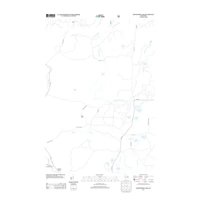
2013 Map of Fredenberg Lake
USGS Topo · Published 2013About this map
The South Branch Oconto River and its various forks dominate this northern landscape, carving through a region defined by its numerous small lakes and glacial waterways. High ground is marked by the La Belle Lookout Tower, which provides a vantage point over the dense woodlands and clearings like Chipmunk Rapids. The map reveals a network of rural routes such as Camp 23 RD and Potato Patch RD, which serve as the primary access points to the area's secluded water bodies.
Find a feature on this map
37 named features on this map. Tap any name to fly to it.
Don’t see what you’re looking for? This feature index may not catch every label — zoom into the map to look around manually.
Map Details
Editions of this 2013 Fredenberg Lake Map
This is the sole edition of this map. No revisions or reprints were ever made.
Other maps of this area

1942 · Breed
USGS Topo · 1:48,000

1952 · Langlade
USGS Topo · 1:48,000

1952 · Mountain
USGS Topo · 1:48,000

1954 · Shawano
USGS Topo · 1:48,000

1954 · Iron Mountain
USGS Topo · 1:250,000

1955 · Green Bay
USGS Topo · 1:250,000

1956 · Gillett
USGS Topo · 1:62,500

1959 · Iron Mountain
USGS Topo · 1:250,000

1964 · Shawano
USGS Topo · 1:62,500
1973 · Mountain
USGS Topo · 1:24,000