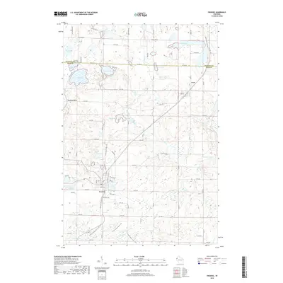
2018 Map of Frederic
USGS Topo · Published 2018About this map
Frederic serves as the primary hub in this corner of northwest Wisconsin, where the Gandy Dancer State Trail follows a clear rail corridor through the heart of the village. The landscape is defined by the glacial legacy of Polk and Burnett Counties, visible in the dense concentration of kettle lakes such as Blom Lake, Coon Lake, and Diamond Lake. These water bodies are connected by a network of drainage systems, including the Wood River and the Trade River to the south.
Find a feature on this map
63 named features on this map. Tap any name to fly to it.
Don’t see what you’re looking for? This feature index may not catch every label — zoom into the map to look around manually.
Map Details
Editions of this 2018 Frederic Map
This is the sole edition of this map. No revisions or reprints were ever made.
Other maps of this area

1950 · Webster
USGS Topo · 1:48,000

1950 · Grantsburg
USGS Topo · 1:48,000

1951 · Milltown
USGS Topo · 1:48,000

1951 · Frederic
USGS Topo · 1:48,000

1953 · Stillwater
USGS Topo · 1:250,000

1955 · Webster
USGS Topo · 1:62,500

1955 · Frederic
USGS Topo · 1:62,500

1955 · Milltown
USGS Topo · 1:62,500

1955 · Stillwater
USGS Topo · 1:250,000

1958 · Stillwater
USGS Topo · 1:250,000