
1953 Map of Frederick
USGS Topo · Published 1955About this map
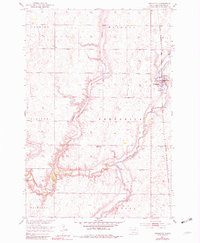
Frederick serves as the primary hub of this 1950s Brown County landscape, situated where the Chicago Milwaukee St Paul and Pacific railroad line runs north-south through the eastern plains. The town is flanked by a complex drainage system, most notably the winding course of the Maple River, which meanders south to its confluence with the Elm River in the lower portion of the quadrangle. This survey was conducted as part of the Department of the Interior program for the development of the Missouri River Basin, documenting the agricultural and water-management patterns of the era.
Find a feature on this map
15 named features on this map. Tap any name to fly to it.
Don’t see what you’re looking for? This feature index may not catch every label — zoom into the map to look around manually.
Map Details
Editions of this 1953 Frederick Map
2 editions found
Other maps of this area

1894 · Ellendale
USGS Topo · 1:62,500

1894 · Columbia
USGS Topo · 1:62,500

1894 · Savo
USGS Topo · 1:62,500

1896 · Columbia
USGS Topo · 1:125,000

1899 · Ellendale
USGS Topo · 1:125,000

1952 · Westport
USGS Topo · 1:24,000

1952 · Richmond NE
USGS Topo · 1:24,000

1953 · Savo SW
USGS Topo · 1:24,000

1953 · Ellendale South
USGS Topo · 1:24,000

1954 · Aberdeen
USGS Topo · 1:250,000