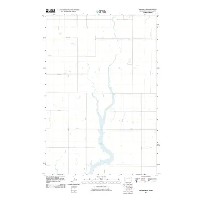
2011 Map of Frederick NW
USGS Topo · Published 2011About this map
The Elm River meanders through the heart of this North Dakota and South Dakota borderland, widening significantly as it forms the expansive Elm Lake in the southern portion of the quadrangle. The terrain is characterized by the intricate drainage of Webber Gulch and a strict section-line grid of rural roads. This 2011 survey captures the area’s sparsely populated agricultural character, where long stretches of roads like 101st St SE and 375th Ave define the landscape. The lack of concentrated settlements highlights a region dedicated to large-scale prairie farming and the seasonal hydrology of the James River Valley watershed, providing a clear record of land use and water management at the state line.
Find a feature on this map
21 named features on this map. Tap any name to fly to it.
Don’t see what you’re looking for? This feature index may not catch every label — zoom into the map to look around manually.
Map Details
Editions of this 2011 Frederick NW Map
This is the sole edition of this map. No revisions or reprints were ever made.
Other maps of this area

1894 · Monango
USGS Topo · 1:62,500

1894 · Ellendale
USGS Topo · 1:62,500

1896 · Edgeley
USGS Topo · 1:125,000

1899 · Ellendale
USGS Topo · 1:125,000

1925 · Edgeley
USGS Topo · 1:125,000

1953 · Jamestown
USGS Topo · 1:250,000

1953 · Frederick
USGS Topo · 1:24,000

1953 · Ellendale South
USGS Topo · 1:24,000

1954 · Aberdeen
USGS Topo · 1:250,000

1956 · Aberdeen
USGS Topo · 1:250,000