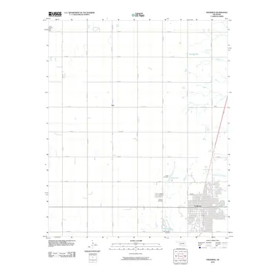
2010 Map of Frederick
USGS Topo · Published 2010About this map
The city of Frederick serves as the primary hub of this Southwest Oklahoma landscape, characterized by a highly organized grid of rural roads and scattered water management projects. Settled at the intersection of the region’s agricultural activity, the area features smaller community markers such as Burt and Hinkle to the north and east. The map documents several local water resources, including Barnard Lake, Burts Lake, and the larger Murray Lake south of town, often regulated by structures like Burts Lake Dam and Redeker Lake Dam. Genealogists and local historians can locate established burial grounds such as the Frederick Cemetery and the Tipton Cemetery, which sit along the periphery of the town's core. The terrain is defined by natural drainage systems like Suttle Creek and Little Deep Red Creek, which contrast with the precision of the section-line roads.
Find a feature on this map
28 named features on this map. Tap any name to fly to it.
Don’t see what you’re looking for? This feature index may not catch every label — zoom into the map to look around manually.
Map Details
Editions of this 2010 Frederick Map
This is the sole edition of this map. No revisions or reprints were ever made.
Other maps of this area

1950 · Snyder
USGS Topo · 1:62,500

1955 · Lawton
USGS Topo · 1:250,000

1956 · Manitou
USGS Topo · 1:24,000

1956 · Snyder
USGS Topo · 1:62,500

1958 · Frederick
USGS Topo · 1:62,500

1964 · Tipton SE
USGS Topo · 1:24,000

1964 · Tipton
USGS Topo · 1:24,000

1974 · Hollister NW
USGS Topo · 1:24,000

1974 · Hackberry Flat
USGS Topo · 1:24,000

1975 · Frederick NE
USGS Topo · 1:24,000