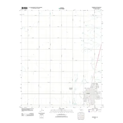
2012 Map of Frederick
USGS Topo · Published 2012About this map
Frederick stands as the primary hub in this portion of Tillman County, exhibiting a dense grid of streets and residential blocks that define the local urban center. Outside the city limits, the landscape transitions into a sprawling agricultural grid defined by numbered section roads such as N2190 Rd and E1780 Rd. This modern digital survey documents the established cemetery sites that serve the surrounding communities, including Frederick Cem located on the northwest edge of town, as well as the outlying Manitou Cem and Tipton Cem. Small water bodies and intermittent drainages like Little Deep Red Cr and Suttle Cr break the geometric regularity of the plains, providing critical drainage for the surrounding farmland. The presence of the named settlement of Burt along the section lines further illustrates the historical distribution of small railway or crossroads communities that once dotted the Oklahoma prairie.
Find a feature on this map
55 named features on this map. Tap any name to fly to it.
Don’t see what you’re looking for? This feature index may not catch every label — zoom into the map to look around manually.
Map Details
Editions of this 2012 Frederick Map
This is the sole edition of this map. No revisions or reprints were ever made.
Other maps of this area

1950 · Snyder
USGS Topo · 1:62,500

1955 · Lawton
USGS Topo · 1:250,000

1956 · Manitou
USGS Topo · 1:24,000

1956 · Snyder
USGS Topo · 1:62,500

1958 · Frederick
USGS Topo · 1:62,500

1964 · Tipton SE
USGS Topo · 1:24,000

1964 · Tipton
USGS Topo · 1:24,000

1974 · Hollister NW
USGS Topo · 1:24,000

1974 · Hackberry Flat
USGS Topo · 1:24,000

1975 · Frederick NE
USGS Topo · 1:24,000