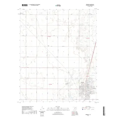
2018 Map of Frederick
USGS Topo · Published 2018About this map
Frederick serves as the primary hub of this Tillman County landscape, where the street grid expands across the southeastern corner of the quadrangle. Residential and commercial development follows a structured layout, defined by major thoroughfares such as N Main St and W Gladstone Ave. The surrounding rural territory is organized by an extensive network of range and township roads, reflecting the region's agricultural heritage. Small water bodies like Barnard Lake and Burts Lake are scattered across the plains, while Little Deep Red Creek meanders through the eastern section. For genealogists, the map is a vital resource for locating rural burials at the Tipton Cemetery, Manitou Cemetery, and Frederick Cemetery. The vanished or diminished settlement of Burt appears as a named location along E1770 Rd, marking a specific point of interest for local historians studying the evolution of Tillman County's rural communities.
Find a feature on this map
62 named features on this map. Tap any name to fly to it.
Don’t see what you’re looking for? This feature index may not catch every label — zoom into the map to look around manually.
Map Details
Editions of this 2018 Frederick Map
This is the sole edition of this map. No revisions or reprints were ever made.
Other maps of this area

1950 · Snyder
USGS Topo · 1:62,500

1955 · Lawton
USGS Topo · 1:250,000

1956 · Manitou
USGS Topo · 1:24,000

1956 · Snyder
USGS Topo · 1:62,500

1958 · Frederick
USGS Topo · 1:62,500

1964 · Tipton SE
USGS Topo · 1:24,000

1964 · Tipton
USGS Topo · 1:24,000

1974 · Hollister NW
USGS Topo · 1:24,000

1974 · Hackberry Flat
USGS Topo · 1:24,000

1975 · Frederick NE
USGS Topo · 1:24,000