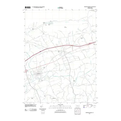
2010 Map of Fredericksburg
USGS Topo · Published 2010About this map
Swatara Creek and its tributary Little Swatara Creek define the landscape south of the Blue Mountain ridge near the turn of the 21st century. The settlement of Jonestown sits at the confluence, serving as a focal point for the surrounding rural developments of Bunker Hills and Rockwood. This survey captures a mix of agricultural tradition and modern recreational land use, featuring several organized retreats such as Camp Strause, Camp Carson, and Camp Arewa tucked against the base of Little Mountain. Private aviation is represented by Farmers Pride Airport and Horst Airport, highlighting the regional connectivity of this Pennsylvania interior. The presence of the Hamlin Cemetery near the eastern edge and various golf courses, including Freeport Mills Golf Course, illustrates the evolution of land use from strictly agrarian to diverse community spaces.
Find a feature on this map
82 named features on this map. Tap any name to fly to it.
Don’t see what you’re looking for? This feature index may not catch every label — zoom into the map to look around manually.
Map Details
Editions of this 2010 Fredericksburg Map
This is the sole edition of this map. No revisions or reprints were ever made.
Other maps of this area

1891 · Lebanon
USGS Topo · 1:62,500

1892 · Lykens
USGS Topo · 1:62,500

1892 · Hummelstown
USGS Topo · 1:62,500

1892 · Pine Grove
USGS Topo · 1:62,500

1893 · Lykens
USGS Topo · 1:62,500

1893 · Lebanon
USGS Topo · 1:62,500

1899 · Lebanon
USGS Topo · 1:62,500

1924 · Hummelstown
USGS Topo · 1:62,500

1943 · Lebanon
USGS Topo · 1:62,500

1943 · Lykens
USGS Topo · 1:62,500
Featured Places
- Bethel Township, PA
- Jonestown, PA
- North Annville Township, PA
- Swatara Township, PA
- Hamlin, Bethel Township