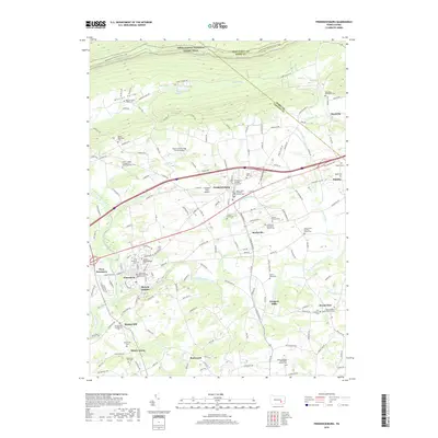
2019 Map of Fredericksburg
USGS Topo · Published 2019About this map
Fredericksburg and Jonestown anchor this part of the Lebanon Valley, showing a dense network of early crossroads and religious heritage sites. Numerous local burial grounds and churches, such as the Jonestown Reformed and Old Cem and Shirksville Mennonite Church Cem, illustrate the deep-rooted German sectarian and local family histories of the region. The landscape is defined by the ridge to the north, where the Appalachian National Scenic Trail follows the high ground above Monroe Valley. Waterways like Little Swatara Creek and Elizabeth Run wind through the valley, supporting a mix of agricultural land and small villages like Shirksville and Meckville. The inclusion of smaller locales such as Mount Ararat and Bunker Hill provides fine-grained detail for genealogists tracing ancestral homesteads near Jonestown. Modern infrastructure, including the Farmers Pride Airport and the William Penn Hwy, shows the evolution of transport alongside traditional footpaths.
Find a feature on this map
79 named features on this map. Tap any name to fly to it.
Don’t see what you’re looking for? This feature index may not catch every label — zoom into the map to look around manually.
Map Details
Editions of this 2019 Fredericksburg Map
This is the sole edition of this map. No revisions or reprints were ever made.
Other maps of this area

1891 · Lebanon
USGS Topo · 1:62,500

1892 · Lykens
USGS Topo · 1:62,500

1892 · Hummelstown
USGS Topo · 1:62,500

1892 · Pine Grove
USGS Topo · 1:62,500

1893 · Lykens
USGS Topo · 1:62,500

1893 · Lebanon
USGS Topo · 1:62,500

1899 · Lebanon
USGS Topo · 1:62,500

1924 · Hummelstown
USGS Topo · 1:62,500

1943 · Lebanon
USGS Topo · 1:62,500

1943 · Lykens
USGS Topo · 1:62,500
Featured Places
- Bethel Township, PA
- Jonestown, PA
- North Annville Township, PA
- Swatara Township, PA
- Hamlin, Bethel Township