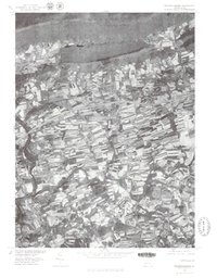
1977 Map of Fredericksburg
USGS Topo · Published 1979About this map
The northern edge of Lebanon County is defined by the prominent ridge of Blue Mountain, which overlooks a dense patchwork of agricultural fields and small settlements in the late 1970s. The landscape is characterized by the winding path of Swatara Creek and its tributary, Little Swatara Creek, which together carve through the rolling valley floor. This orthophotograph, produced in cooperation with the Soil Conservation Service, provides a detailed look at the rural economy and land use patterns around Jonestown and Fredericksburg. The imagery reveals the varied textures of active farmland surrounding established villages like Bunker Hill and Mt Zion. Further south, the map captures the residential and industrial growth near Rockwood, where the transition from field to town is clearly visible in the aerial perspective.
Find a feature on this map
8 named features on this map. Tap any name to fly to it.
Don’t see what you’re looking for? This feature index may not catch every label — zoom into the map to look around manually.
Map Details
Editions of this 1977 Fredericksburg Map
This is the sole edition of this map. No revisions or reprints were ever made.
Other maps of this area

1891 · Lebanon
USGS Topo · 1:62,500

1892 · Lykens
USGS Topo · 1:62,500

1892 · Hummelstown
USGS Topo · 1:62,500

1892 · Pine Grove
USGS Topo · 1:62,500

1893 · Lykens
USGS Topo · 1:62,500

1893 · Lebanon
USGS Topo · 1:62,500

1899 · Lebanon
USGS Topo · 1:62,500

1924 · Hummelstown
USGS Topo · 1:62,500

1943 · Lebanon
USGS Topo · 1:62,500

1943 · Lykens
USGS Topo · 1:62,500
Featured Places
- Bethel Township, PA
- Jonestown, PA
- Union Township, PA
- Swatara Township, PA
- Fredericksburg, Bethel Township