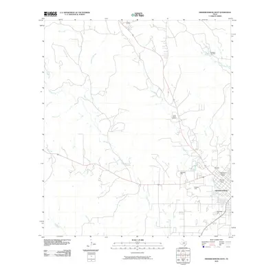
2010 Map of Fredericksburg West
USGS Topo · Published 2010About this map
The Fredericksburg Historic District anchors the southeastern corner of this study, reflecting the enduring layout of this German-founded Hill Country community. The landscape is defined by a dense network of waterways branching away from Fredericksburg, including the winding courses of Live Oak Creek and Barons Creek. These streams cut through a series of prominent elevations such as Schlaudt Hills, Hotopp Hills, and Schneider Hill, which shape the local ranching and residential patterns. Rural heritage is visible in the placement of the Schugh Cemetery to the north and the Saint Mary Cemetery near the town center. The presence of the Carter Ranch Stolport and the Douglass Lake Dam illustrates how modern aviation and water management have been integrated into this traditional agricultural and historic setting.
Find a feature on this map
25 named features on this map. Tap any name to fly to it.
Don’t see what you’re looking for? This feature index may not catch every label — zoom into the map to look around manually.
Map Details
Editions of this 2010 Fredericksburg West Map
This is the sole edition of this map. No revisions or reprints were ever made.
Other maps of this area

1894 · Fredericksburg
USGS Topo · 1:125,000

1894 · Kerrville
USGS Topo · 1:125,000

1954 · Llano
USGS Topo · 1:250,000

1955 · Llano
USGS Topo · 1:250,000

1956 · Llano
USGS Topo · 1:250,000

1963 · Cain City
USGS Topo · 1:24,000

1964 · Oak Crest Park
USGS Topo · 1:24,000

1964 · Morris Ranch
USGS Topo · 1:24,000
1967 · Cherry Mountain
USGS Topo · 1:24,000

1967 · Fredericksburg East
USGS Topo · 1:24,000