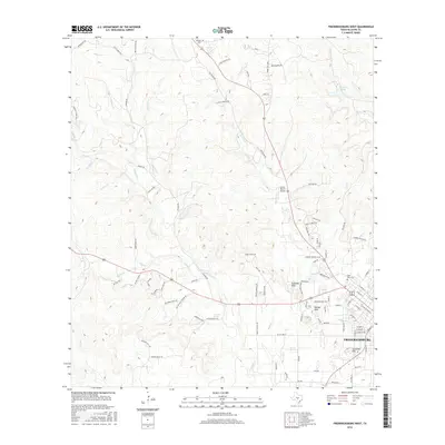
2016 Map of Fredericksburg West
USGS Topo · Published 2016About this map
Fredericksburg anchor the southeastern corner of this study, where the Hill Country landscape gives way to a dense network of residential streets and local landmarks. The map illustrates the westward expansion of the settlement toward the rolling elevations of Schneider Hill and the Schlaudt Hills. Rural life is marked by longstanding family-named routes such as Old Mason Rd and McCullough Burrer Rd, while numerous waterways including Barons Cr and Live Oak Cr carve through the limestone terrain.
Find a feature on this map
97 named features on this map. Tap any name to fly to it.
Don’t see what you’re looking for? This feature index may not catch every label — zoom into the map to look around manually.
Map Details
Editions of this 2016 Fredericksburg West Map
This is the sole edition of this map. No revisions or reprints were ever made.
Other maps of this area

1894 · Fredericksburg
USGS Topo · 1:125,000

1894 · Kerrville
USGS Topo · 1:125,000

1954 · Llano
USGS Topo · 1:250,000

1955 · Llano
USGS Topo · 1:250,000

1956 · Llano
USGS Topo · 1:250,000

1963 · Cain City
USGS Topo · 1:24,000

1964 · Oak Crest Park
USGS Topo · 1:24,000

1964 · Morris Ranch
USGS Topo · 1:24,000
1967 · Cherry Mountain
USGS Topo · 1:24,000

1967 · Fredericksburg East
USGS Topo · 1:24,000