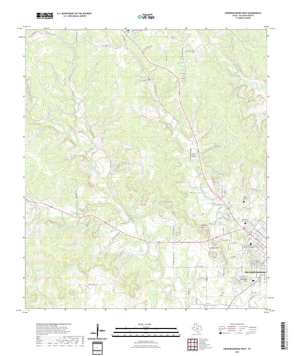
2022 Map of Fredericksburg West
USGS Topo · Published 2022About this map
The western edges of Fredericksburg anchor this 2022 survey, illustrating the modern expansion of this Gillespie County seat. Local heritage is preserved in sites like the Old Catholic Cem and Saint Marys Memorial Cem, while newer residential developments such as Schlaudt Hills and Hotopp Hills indicate recent growth patterns. The landscape is defined by the limestone-cut drainages of Barons Cr and Live Oak Cr, punctuated by high points like Schneider Hill.
Find a feature on this map
109 named features on this map. Tap any name to fly to it.
Don’t see what you’re looking for? This feature index may not catch every label — zoom into the map to look around manually.
Map Details
Editions of this 2022 Fredericksburg West Map
This is the sole edition of this map. No revisions or reprints were ever made.
Other maps of this area

1894 · Fredericksburg
USGS Topo · 1:125,000

1894 · Kerrville
USGS Topo · 1:125,000

1954 · Llano
USGS Topo · 1:250,000

1955 · Llano
USGS Topo · 1:250,000

1956 · Llano
USGS Topo · 1:250,000

1963 · Cain City
USGS Topo · 1:24,000

1964 · Oak Crest Park
USGS Topo · 1:24,000

1964 · Morris Ranch
USGS Topo · 1:24,000
1967 · Cherry Mountain
USGS Topo · 1:24,000

1967 · Fredericksburg East
USGS Topo · 1:24,000