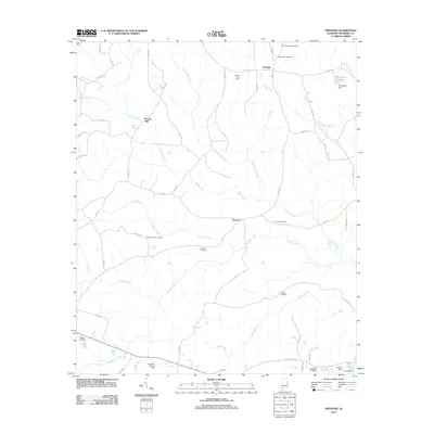
2011 Map of Fredonia
USGS Topo · Published 2011About this map
The settlement of Fredonia and its surrounding rural landscapes are meticulously detailed in this early 21st-century study of Chambers County. This area is characterized by a high concentration of generational burial sites, such as the Swint-Hammack Cemetery, New Hope Cemetery, and Emory Chapel Cemetery, which offer significant value for genealogists tracing local families. The landscape is defined by the winding paths of Wells Creek and Finley Creek, interspersed with small-scale water management features like Thompson Dam and Kendrick-Holmes Dam.
Find a feature on this map
54 named features on this map. Tap any name to fly to it.
Don’t see what you’re looking for? This feature index may not catch every label — zoom into the map to look around manually.
Map Details
Editions of this 2011 Fredonia Map
This is the sole edition of this map. No revisions or reprints were ever made.
Other maps of this area

1899 · Wedowee
USGS Topo · 1:125,000

1902 · Wedowee
USGS Topo · 1:125,000

1907 · Opelika
USGS Topo · 1:125,000

1909 · Opelika
USGS Topo · 1:125,000

1953 · Atlanta
USGS Topo · 1:250,000

1955 · Phenix City
USGS Topo · 1:250,000

1957 · Phenix City
USGS Topo · 1:250,000

1957 · Atlanta
USGS Topo · 1:250,000

1958 · Phenix City
USGS Topo · 1:250,000

1958 · Atlanta
USGS Topo · 1:250,000