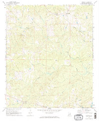
1971 Map of Fredonia
USGS Topo · Published 1973About this map
Fredonia serves as the primary settlement in this northeast Alabama landscape, characterized by a high concentration of rural sanctuaries and family-named watercourses. The local road network connects small communities like Denson and Wards Mill, while a prominent Lookout Tower stands near Mt Zion Ch to the north. The area is deeply defined by its drainage patterns, with Oseligee Creek and Hardley Creek winding through the terrain toward the east.
Find a feature on this map
21 named features on this map. Tap any name to fly to it.
Don’t see what you’re looking for? This feature index may not catch every label — zoom into the map to look around manually.
Map Details
Editions of this 1971 Fredonia Map
2 editions found
Other maps of this area

1899 · Wedowee
USGS Topo · 1:125,000

1902 · Wedowee
USGS Topo · 1:125,000

1907 · Opelika
USGS Topo · 1:125,000

1909 · Opelika
USGS Topo · 1:125,000

1953 · Atlanta
USGS Topo · 1:250,000

1955 · Phenix City
USGS Topo · 1:250,000

1957 · Phenix City
USGS Topo · 1:250,000

1957 · Atlanta
USGS Topo · 1:250,000

1958 · Phenix City
USGS Topo · 1:250,000

1958 · Atlanta
USGS Topo · 1:250,000