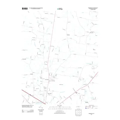
2013 Map of Fredonia
USGS Topo · Published 2013About this map
Duck River headwaters wind through this portion of Coffee County, where established rural communities and family landholdings define the landscape. The map highlights the clustered residential growth at New Union and the surrounding hamlets of Fredonia and Forest Mill. These settlements are linked by a network of local routes such as Ogles Cemetery Rd and Dick Wiser Rd, reflecting a history of small-scale agriculture and neighborhood-centered life.
Find a feature on this map
173 named features on this map. Tap any name to fly to it.
Don’t see what you’re looking for? This feature index may not catch every label — zoom into the map to look around manually.
Map Details
Editions of this 2013 Fredonia Map
This is the sole edition of this map. No revisions or reprints were ever made.
Other maps of this area

1893 · Mc Minnville
USGS Topo · 1:125,000

1895 · Mc Minnville
USGS Topo · 1:125,000

1895 · Sewanee
USGS Topo · 1:125,000

1913 · Hollow Springs
USGS Topo · 1:62,500

1936 · Ovoca
USGS Topo · 1:24,000

1936 · Fredonia
USGS Topo · 1:24,000

1936 · Manchester
USGS Topo · 1:24,000

1936 · Beech Grove
USGS Topo · 1:24,000

1936 · Petty Gap
USGS Topo · 1:24,000

1936 · Noah
USGS Topo · 1:24,000