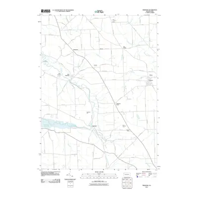
2010 Map of Fredonia
USGS Topo · Published 2010About this map
Fredonia serves as the primary hub in this western Pennsylvania landscape, where the waters of Mill Run join the larger drainage networks of Mercer County. The Shenango River meanders through the central terrain, creating the prominent Big Bend Hill and feeding into the Shenango River Lake to the southwest. This area is characterized by several small, dispersed settlements including Oniontown, New Hamburg, and Delaware Grove, many of which are connected by a grid of named rural roads like Saint Johns Rd and Fredonia Rd. Local history is anchored by several sites of interment, such as Millbank Cemetery near the borough of Fredonia and the northern Busch Cemetery at Kitchens Corners. The presence of recreation and community gathering places like Camp Kiondashawa, Temple Grove Campground, and the Mercer Public Golf Course highlights the region's transition into a modern recreational landscape.
Find a feature on this map
90 named features on this map. Tap any name to fly to it.
Don’t see what you’re looking for? This feature index may not catch every label — zoom into the map to look around manually.
Map Details
Editions of this 2010 Fredonia Map
This is the sole edition of this map. No revisions or reprints were ever made.
Other maps of this area

1905 · Neshannock
USGS Topo · 1:62,500

1907 · Neshannock
USGS Topo · 1:62,500

1908 · Shenango
USGS Topo · 1:62,500

1911 · Stoneboro
USGS Topo · 1:62,500

1913 · Stoneboro
USGS Topo · 1:62,500

1913 · Mercer
USGS Topo · 1:62,500

1939 · Mercer
USGS Topo · 1:62,500

1943 · Mercer
USGS Topo · 1:62,500

1943 · Stoneboro
USGS Topo · 1:62,500

1950 · Cleveland
USGS Topo · 1:250,000
Featured Places
- Fairview Township, PA
- Fredonia, PA
- Perry Township, PA
- Jefferson Township, PA
- Delaware Grove, Delaware Township