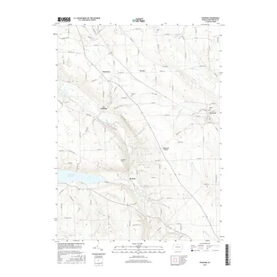
2016 Map of Fredonia
USGS Topo · Published 2016About this map
The Shenango River Lake and its winding tributaries define this portion of Mercer County, where the village of Fredonia sits as a primary eastern hub. The landscape is dotted with smaller, distinct settlements including New Hamburg, Kremis, and Oniontown, reflecting the traditional rural development patterns of western Pennsylvania. Waterways like Lackawannock Cr and Neshannock Cr cut through the terrain, which rises to its most prominent point at Big Bend Hill near the river's sharp curve at Big Bend. Local history is anchored by several burial grounds, such as Millbank Cem and Delaware Cem, which serve as vital markers for genealogical research in this region. The map also traces a dense network of township roads, including the aptly named Kidds Mills Rd and Wasser Bridge Rd, which hint at the industrial and agricultural crossings of earlier generations.
Find a feature on this map
97 named features on this map. Tap any name to fly to it.
Don’t see what you’re looking for? This feature index may not catch every label — zoom into the map to look around manually.
Map Details
Editions of this 2016 Fredonia Map
This is the sole edition of this map. No revisions or reprints were ever made.
Other maps of this area

1905 · Neshannock
USGS Topo · 1:62,500

1907 · Neshannock
USGS Topo · 1:62,500

1908 · Shenango
USGS Topo · 1:62,500

1911 · Stoneboro
USGS Topo · 1:62,500

1913 · Stoneboro
USGS Topo · 1:62,500

1913 · Mercer
USGS Topo · 1:62,500

1939 · Mercer
USGS Topo · 1:62,500

1943 · Mercer
USGS Topo · 1:62,500

1943 · Stoneboro
USGS Topo · 1:62,500

1950 · Cleveland
USGS Topo · 1:250,000
Featured Places
- Fairview Township, PA
- Fredonia, PA
- Perry Township, PA
- Jefferson Township, PA
- Delaware Grove, Delaware Township