2023 Map of Fredonia
USGS Topo · Published 2023About this map
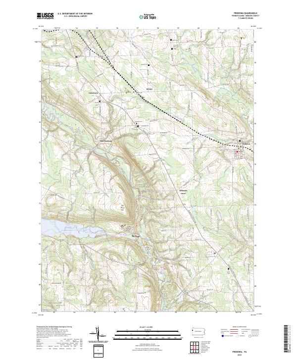
Shenango River Lake dominates the western landscape of this Mercer County survey, where the winding Shenango River meets the prominent elevation of Big Bend Hill. This modern mapping of the Fredonia vicinity reveals a complex network of rural townships connected by historically named routes like Kidds Mills Rd and Wasser Bridge Rd. The distribution of small settlements such as New Hamburg, Oniontown, and Delaware Grove suggests a persistent pattern of rural community centers anchored by long-standing local landmarks.
Find a feature on this map
113 named features on this map. Tap any name to fly to it.
Don’t see what you’re looking for? This feature index may not catch every label — zoom into the map to look around manually.
Map Details
Editions of this 2023 Fredonia Map
This is the sole edition of this map. No revisions or reprints were ever made.