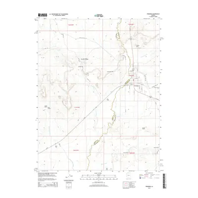
2014 Map of Fredonia
USGS Topo · Published 2014About this map
Fredonia serves as the primary hub in this arid landscape near the Arizona-Utah border, situated where Us-89-Alt and Az-389 converge. The town's grid is detailed with residential streets such as E Hortt St and S Maurice Ave, while the surrounding terrain is defined by dramatic geologic features. To the west, the community of Sixmile Village sits near Sixmile Gap and the rising Shinarump Cliffs, reflecting a settlement pattern dictated by the few available water sources like Cottonwood Spring and Sixmile Spring.
Find a feature on this map
58 named features on this map. Tap any name to fly to it.
Don’t see what you’re looking for? This feature index may not catch every label — zoom into the map to look around manually.
Map Details
Editions of this 2014 Fredonia Map
This is the sole edition of this map. No revisions or reprints were ever made.
Other maps of this area

1886 · Kanab
USGS Topo · 1:250,000

1886 · Kaibab
USGS Topo · 1:250,000

1953 · Cedar City
USGS Topo · 1:250,000

1953 · Grand Canyon
USGS Topo · 1:250,000

1954 · Kanab SW
USGS Topo · 1:24,000

1954 · Fredonia NW
USGS Topo · 1:24,000

1954 · Kanab SE
USGS Topo · 1:24,000

1954 · Shinarump NW
USGS Topo · 1:24,000

1954 · Fredonia SW
USGS Topo · 1:24,000

1954 · Johnson SW
USGS Topo · 1:24,000