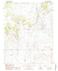
1988 Map of Fredonia
USGS Topo · Published 1988About this map
The Kaibab Indian Reservation dominates the western half of this 1980s landscape, where the plateau is sharply defined by the Shinarump Cliffs. The town of Fredonia serves as the primary hub of activity, featuring a concentrated street grid, a local Cem, and Athletic Fields. Industrial elements are visible on the outskirts, including an Oil Refinery and a Radio Tower, reflecting the regional economy during this period. To the west, Sixmile Village sits near the base of the cliffs, supported by water sources like Sixmile Spring. The terrain is marked by distinctive geological formations such as Steamboat Rock, Cowboy Butte, and the Flat Tops, while the drainage system of Kanab Creek and Johnson Wash provides the fundamental structure for the high-desert topography. This survey captures a moment when traditional tribal lands and small-town infrastructure coexisted with modern energy and communications utilities.
Find a feature on this map
25 named features on this map. Tap any name to fly to it.
Don’t see what you’re looking for? This feature index may not catch every label — zoom into the map to look around manually.
Map Details
Editions of this 1988 Fredonia Map
This is the sole edition of this map. No revisions or reprints were ever made.
Other maps of this area

1886 · Kanab
USGS Topo · 1:250,000

1886 · Kaibab
USGS Topo · 1:250,000

1953 · Cedar City
USGS Topo · 1:250,000

1953 · Grand Canyon
USGS Topo · 1:250,000

1954 · Kanab SW
USGS Topo · 1:24,000

1954 · Fredonia NW
USGS Topo · 1:24,000

1954 · Kanab SE
USGS Topo · 1:24,000

1954 · Shinarump NW
USGS Topo · 1:24,000

1954 · Fredonia SW
USGS Topo · 1:24,000

1954 · Johnson SW
USGS Topo · 1:24,000