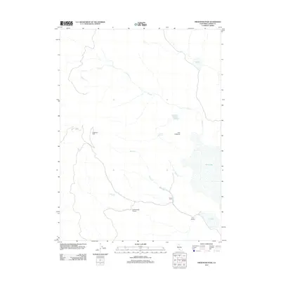
2012 Map of Fredonyer Peak
USGS Topo · Published 2012About this map
Fredonyer Peak and the high desert terrain of Lassen County dominate this 2012 survey, illustrating a landscape defined by seasonal water management and ranching. The map shows a sophisticated system of high-elevation catchment, including Branham Reservoir, Fredonyer Reservoir, and Craemer Reservoir, which support local agricultural interests like Woods Ranch. These water sources, alongside Craemer Springs and Cottonwood Spring, are vital lifelines in the arid territory north of Horse Lake. The drainage patterns of Shoals Cr and Pine Cr carve through prominent landforms such as Cottonwood Canyon and Long Canyon. This map serves as a detailed record of contemporary land use in a region where natural springs and man-made reservoirs dictate the footprint of human activity and livestock grazing.
Find a feature on this map
14 named features on this map. Tap any name to fly to it.
Don’t see what you’re looking for? This feature index may not catch every label — zoom into the map to look around manually.
Map Details
Editions of this 2012 Fredonyer Peak Map
This is the sole edition of this map. No revisions or reprints were ever made.
Other maps of this area

1886 · Honey Lake
USGS Topo · 1:250,000

1891 · Honey Lake
USGS Topo · 1:250,000

1893 · Honey Lake
USGS Topo · 1:250,000

1954 · Karlo
USGS Topo · 1:62,500

1954 · Grasshopper Valley
USGS Topo · 1:62,500

1954 · Ravendale
USGS Topo · 1:62,500

1954 · Fredonyer Peak
USGS Topo · 1:62,500

1955 · Westwood
USGS Topo · 1:250,000

1958 · Westwood
USGS Topo · 1:250,000

1959 · Westwood
USGS Topo · 1:250,000