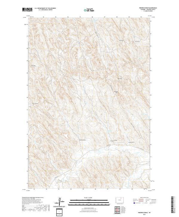
2021 Map of Fredrick Draw
USGS Topo · Published 2021About this map
Fredrick Draw and its namesake watershed define this portion of Johnson County, characterized by a complex network of seasonal drainage channels and ranching infrastructure. The landscape is marked by a series of localized catchments including Rattlesnake Number 1 Reservoir and Antelope Reservoir, which support livestock in this arid terrain. Access is provided by rural routes such as Tipperary Rd and Double Cross Rd, which traverse the high ground between features like Antelope Basin and McMillan Draw. The mapping reveals a subtle but critical water system where ephemeral flows eventually reach Crazy Woman Cr and Dry Cr. This 2021 study documents the persistence of traditional land use and grazing boundaries, reflected in the numerous family or locally-named draws like Cook Draw, Sony Draw, and Julio Draw that segment the prairie.
Find a feature on this map
23 named features on this map. Tap any name to fly to it.
Don’t see what you’re looking for? This feature index may not catch every label — zoom into the map to look around manually.
Map Details
Editions of this 2021 Fredrick Draw Map
This is the sole edition of this map. No revisions or reprints were ever made.
Other maps of this area

1900 · Fort McKinney
USGS Topo · 1:125,000

1903 · Fort McKinney
USGS Topo · 1:125,000

1909 · Sheridan
USGS Topo · 1:125,000

1911 · Sheridan
USGS Topo · 1:125,000

1955 · Sheridan
USGS Topo · 1:250,000

1958 · Sheridan
USGS Topo · 1:250,000

1962 · Sheridan
USGS Topo · 1:250,000

1970 · Buffalo NE
USGS Topo · 1:24,000
1970 · Buffalo SE
USGS Topo · 1:24,000
1970 · Ucross
USGS Topo · 1:24,000