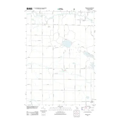
2012 Map of Free Soil
USGS Topo · Published 2012About this map
The Big Sable River meanders across this northern Mason County landscape, defining a terrain shaped by glacial hydrology and rural settlement. In the early 21st century, the area remains characterized by its dense network of local schools and cemeteries that anchor the community's history. From the Saint John Cantius' Cem in the north to the Batcheller Christ Cem near the settlement of Batcheller in the south, these sites provide significant touchstones for genealogical research. The map documents a transition from the northern river drainage to the S Br Lincoln River system, punctuated by numerous named water bodies like Gun Lake and Ford Lake. The presence of several historic educational sites, including Howell School and Elm Flats School, suggests a distributed pattern of rural life that persists alongside the county's significant natural water resources.
Find a feature on this map
75 named features on this map. Tap any name to fly to it.
Don’t see what you’re looking for? This feature index may not catch every label — zoom into the map to look around manually.
Map Details
Editions of this 2012 Free Soil Map
This is the sole edition of this map. No revisions or reprints were ever made.
Other maps of this area

1931 · Custer NW
USGS Topo · 1:31,680

1931 · Custer NE
USGS Topo · 1:31,680

1931 · Manistee SE
USGS Topo · 1:31,680

1931 · Freesoil SW
USGS Topo · 1:31,680

1932 · Freesoil SE
USGS Topo · 1:31,680

1932 · Ludington NE
USGS Topo · 1:31,680

1954 · Milwaukee
USGS Topo · 1:250,000

1954 · Manitowoc
USGS Topo · 1:250,000

1957 · Freesoil
USGS Topo · 1:62,500

1958 · Manitowoc
USGS Topo · 1:250,000