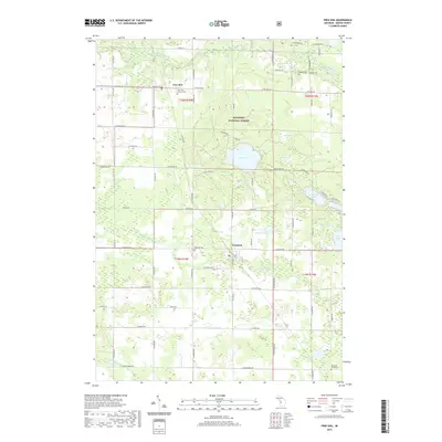
2019 Map of Free Soil
USGS Topo · Published 2019About this map
Free Soil and Fountain serve as the primary hubs of this Mason County landscape, situated within the eastern reaches of the Manistee National Forest. The topography is defined by an intricate network of glacial lakes and waterways, with the Big Sable River carving through the northern section and the N Br Lincoln River and S Br Lincoln River draining the southern township. The drainage patterns around Gun Lake, Lake Meade, and Thunder Lake illustrate a terrain where forest and wetland frequently intersect.
Find a feature on this map
66 named features on this map. Tap any name to fly to it.
Don’t see what you’re looking for? This feature index may not catch every label — zoom into the map to look around manually.
Map Details
Editions of this 2019 Free Soil Map
This is the sole edition of this map. No revisions or reprints were ever made.
Other maps of this area

1931 · Custer NW
USGS Topo · 1:31,680

1931 · Custer NE
USGS Topo · 1:31,680

1931 · Manistee SE
USGS Topo · 1:31,680

1931 · Freesoil SW
USGS Topo · 1:31,680

1932 · Freesoil SE
USGS Topo · 1:31,680

1932 · Ludington NE
USGS Topo · 1:31,680

1954 · Milwaukee
USGS Topo · 1:250,000

1954 · Manitowoc
USGS Topo · 1:250,000

1957 · Freesoil
USGS Topo · 1:62,500

1958 · Manitowoc
USGS Topo · 1:250,000