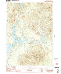
1987 Map of Freedom
USGS Topo · Published 1987About this map
The village of Freedom sits at the heart of this landscape, where the waters of Loon Lake and the Ossipee River flow through the foothills of the White Mountains. By the late 1980s, this area of Carroll County remained defined by its expansive water bodies, including Leavitt Bay, Berry Bay, and the sandy reaches of Long Sands on the edge of Ossipee Lake. The map details the established recreational character of the region, noting locations like Camp Huckins and Camp Marist, alongside the protected acreage of Ossipee Lake State Park and Green Mountain State Forest.
Find a feature on this map
54 named features on this map. Tap any name to fly to it.
Don’t see what you’re looking for? This feature index may not catch every label — zoom into the map to look around manually.
Map Details
Editions of this 1987 Freedom Map
2 editions found
Other maps of this area

1891 · Newfield
USGS Topo · 1:62,500

1893 · Newfield
USGS Topo · 1:62,500

1910 · Kezar Falls
USGS Topo · 1:48,000

1911 · Kezar Falls
USGS Topo · 1:62,500

1928 · Wolfeboro
USGS Topo · 1:62,500

1930 · Ossipee Lake
USGS Topo · 1:62,500

1933 · Newfield
USGS Topo · 1:48,000

1937 · Newfield
USGS Topo · 1:62,500

1942 · Newfield
USGS Topo · 1:62,500

1944 · Newfield
USGS Topo · 1:62,500