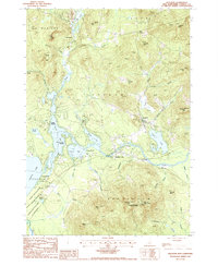
1987 Map of Freedom
USGS Topo · Published 1987About this map
The Ossipee River serves as the focal point for this landscape, winding eastward from the interconnected waters of Berry Bay and Leavitt Bay. The settlement of Freedom is positioned near the base of Prospect Mtn, while Effingham Falls marks a significant crossing point to the south. This 1980s survey captures the area's established role as a recreational and conservation hub, featuring Ossipee Lake State Park along the shoreline and the expansive Green Mountain State Forest covering the high peaks of Hanson Top and Davis Top. The map details a network of summer camps and residential clusters like Ossipee Lake Shores and Camp Marist, alongside family-named landmarks such as Youngs Hill and Durgin Hill that reflect the region's long-standing land-use patterns.
Find a feature on this map
56 named features on this map. Tap any name to fly to it.
Don’t see what you’re looking for? This feature index may not catch every label — zoom into the map to look around manually.
Map Details
Editions of this 1987 Freedom Map
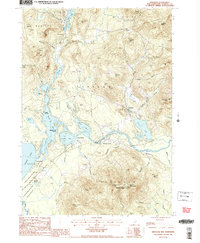
2 editions found
Other maps of this area

1891 · Newfield
USGS Topo · 1:62,500

1893 · Newfield
USGS Topo · 1:62,500

1910 · Kezar Falls
USGS Topo · 1:48,000

1911 · Kezar Falls
USGS Topo · 1:62,500

1928 · Wolfeboro
USGS Topo · 1:62,500

1930 · Ossipee Lake
USGS Topo · 1:62,500

1933 · Newfield
USGS Topo · 1:48,000

1937 · Newfield
USGS Topo · 1:62,500

1942 · Newfield
USGS Topo · 1:62,500

1944 · Newfield
USGS Topo · 1:62,500