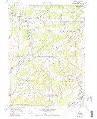
1963 Map of Freedom
USGS Topo · Published 1990About this map
Freedom and the surrounding townships of Centerville, Farmersville, and Rushford are depicted here during a period of mid-century stability. The landscape is characterized by its agricultural character and extensive State Reforestation Areas, which are interspersed among the headwaters of Caneadea Creek and Clear Creek. The transportation network is defined by legacy infrastructure, including the Old RR Grade and the Baltimore and Ohio Road, reflecting the importance of historical rail corridors in connecting these rural outposts.
Find a feature on this map
54 named features on this map. Tap any name to fly to it.
Don’t see what you’re looking for? This feature index may not catch every label — zoom into the map to look around manually.
Map Details
Editions of this 1963 Freedom Map
3 editions found
Other maps of this area

1905 · Portage
USGS Topo · 1:62,500

1906 · Angelica
USGS Topo · 1:62,500

1923 · Arcade
USGS Topo · 1:62,500

1924 · Franklinville
USGS Topo · 1:62,500

1925 · Arcade
USGS Topo · 1:62,500

1941 · Angelica
USGS Topo · 1:62,500

1942 · Franklinville
USGS Topo · 1:62,500

1943 · Pike
USGS Topo · 1:24,000

1944 · Pike
USGS Topo · 1:31,680

1960 · Buffalo
USGS Topo · 1:250,000