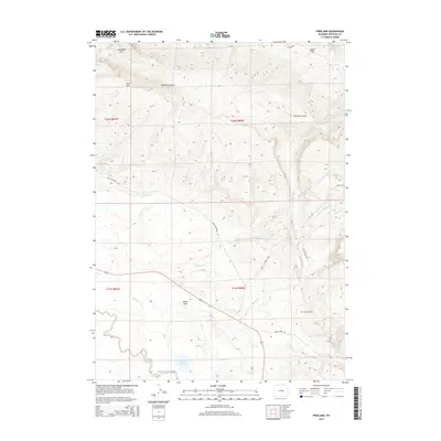
2015 Map of Freeland
USGS Topo · Published 2015About this map
Bates Hole defines the southwestern drainage of this Natrona County landscape, where the high ridges of Casper Mtn and Limestone Hill transition into a complex network of draws and creeks. This 2015 survey shows a terrain marked by intense topographical relief, centered on the historic Freeland Cem and the surrounding ranching country. The intricate hydrology of the area is represented by numerous seasonal and permanent waterways, including Big Red Cr, Little Red Cr, and the winding course of Bates Cr.
Find a feature on this map
26 named features on this map. Tap any name to fly to it.
Don’t see what you’re looking for? This feature index may not catch every label — zoom into the map to look around manually.
Map Details
Editions of this 2015 Freeland Map
This is the sole edition of this map. No revisions or reprints were ever made.
Other maps of this area

1950 · Emigrant Gap
USGS Topo · 1:24,000

1950 · Goose Egg
USGS Topo · 1:24,000

1950 · Alcova SE
USGS Topo · 1:24,000

1951 · Casper
USGS Topo · 1:24,000

1951 · Bessemer Mountain
USGS Topo · 1:24,000

1955 · Casper
USGS Topo · 1:250,000

1958 · Casper
USGS Topo · 1:250,000
1960 · Emigrant Gap
USGS Topo · 1:24,000

1960 · Twin Buttes
USGS Topo · 1:24,000

1960 · Crimson Dawn
USGS Topo · 1:24,000