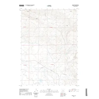
2021 Map of Freeland
USGS Topo · Published 2021About this map
Bates Hole and the southern slopes of Casper Mtn define this section of Natrona County, where high-altitude drainages carve through a complex topographic landscape. The map reveals a remote ranching and transit corridor centered on the Freeland Cem, a vital point of reference for genealogists tracing early families in this rugged interior. Seasonal water management is evident at the Schnoor Reservoir, while the passage of time is marked by historical transportation routes like the Old Casper Medicine Bow Hwy. From the heights of Coal Mtn and Limestone Hill to the winding paths of Bates Cr and Little Red Cr, the geography reflects the traditional land use patterns of central Wyoming. This contemporary survey captures the enduring rural character of the region, including named landmarks like Jackson Canyon and Gotheberg Draw.
Find a feature on this map
27 named features on this map. Tap any name to fly to it.
Don’t see what you’re looking for? This feature index may not catch every label — zoom into the map to look around manually.
Map Details
Editions of this 2021 Freeland Map
This is the sole edition of this map. No revisions or reprints were ever made.
Other maps of this area

1950 · Emigrant Gap
USGS Topo · 1:24,000

1950 · Goose Egg
USGS Topo · 1:24,000

1950 · Alcova SE
USGS Topo · 1:24,000

1951 · Casper
USGS Topo · 1:24,000

1951 · Bessemer Mountain
USGS Topo · 1:24,000

1955 · Casper
USGS Topo · 1:250,000

1958 · Casper
USGS Topo · 1:250,000
1960 · Emigrant Gap
USGS Topo · 1:24,000

1960 · Twin Buttes
USGS Topo · 1:24,000

1960 · Crimson Dawn
USGS Topo · 1:24,000